Howse Peak Northeast Buttress
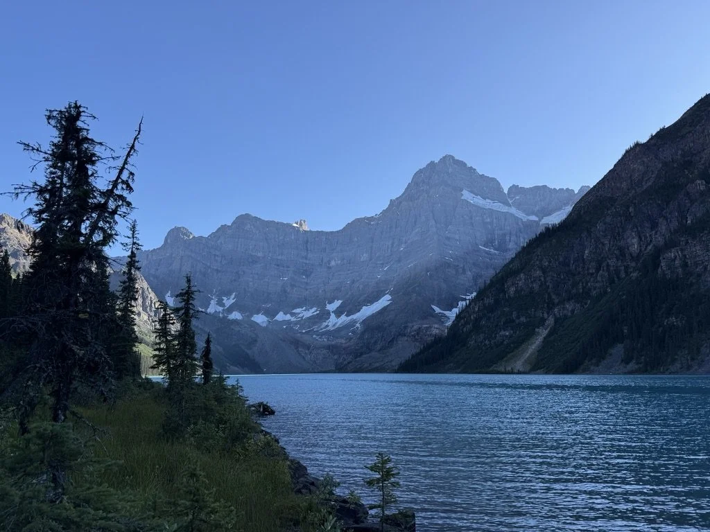
It’s been an unseasonably wet summer here in the Rockies and a bit more tricky than typical to find a good stretch of stable weather for more involved objectives. Venturing on the North Face of Howse Peak was a last-minute decision that we made to jump on an extended period of terrific weather. Sara and I had initially been thinking we’d like to check out the N.E. Ridge of Alberta if some good weather appeared, but when we checked in to book the hut we learned it was already fully booked — this meant that even if no one was climbing the N.E. Ridge, we’d still have to contend with at least six people on the descent of the Japanese Route, which was far from ideal.
A few years ago I had made a short-lived attempt on Howse’s N.E. Buttress with my good friend, but we bailed about ~250 meters up the route, realizing that our somewhat casual alpine start wasn’t going to cut it for an in-a-day ascent. We drove out to Howse late Friday afternoon after trying to both wrap up our work tasks for the week. Our first obstacle to assess was the Mistaya River crossing, which we heard could be quite deep. Fortunately, it didn’t appear to be unfordable — potentially deep but slow moving.
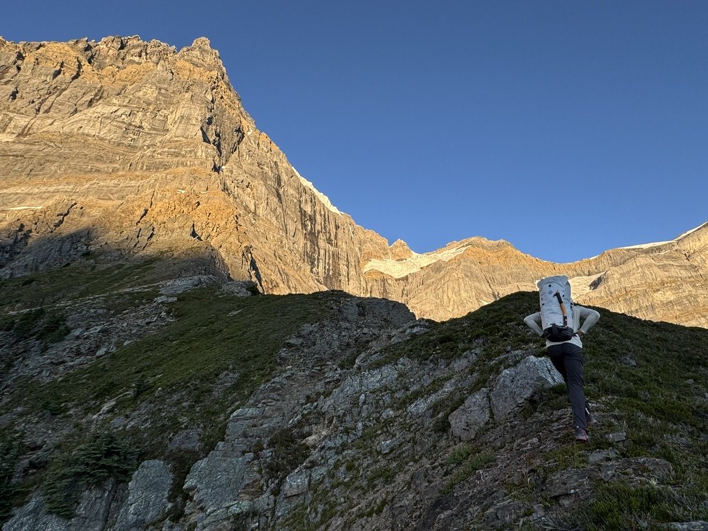
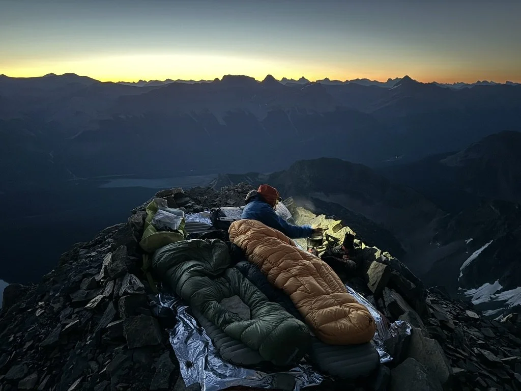
Our first day on the route had us gain up to the main bivy ledge located just under the yellow band of rock. With great indecisiveness, we couldn’t commit to either doing the route in a push or bivying. Ultimately we carried up sleeping bags and pads along with a stove, but decided to only bring one day’s worth of food, which we figured we could stretch if needed. We did get a little off route where the route traverses out right to the north — we will blame this on bad beta. Some shenanigans to regain the route ate up some time. Upon reaching the flat spot around 5 PM, we opted to take a casual evening and just enjoy the spectacular camping spot, which even had a good water source nearby.
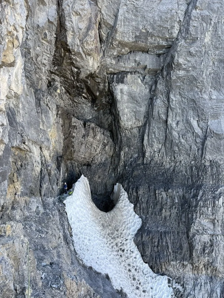
We woke to a beautiful sunrise after both having very comfortable sleeps and, of course, some coffee courtesy of Starbucks Instant VIAs. Figuring we’d make good time through the upper headwall and the descent would be somewhat straightforward due to some beta we had received, we didn’t rush to get moving. Unfortunately, right off the bat we had some tedious climbing that was slow moving through the yellow band. It wasn’t overly difficult, but the rock was poor quality, requiring a bit more care as I picked my way through the choss. We then spent some time deliberating the correct route through the black band thanks to some hesitation to traverse out onto the face, as a fairly steady stream of rock came flying down from upper reaches of the face. Certainly my helmet proved its worth on this outing!
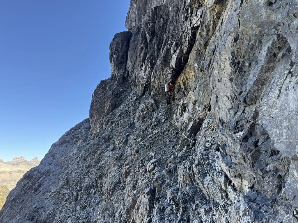
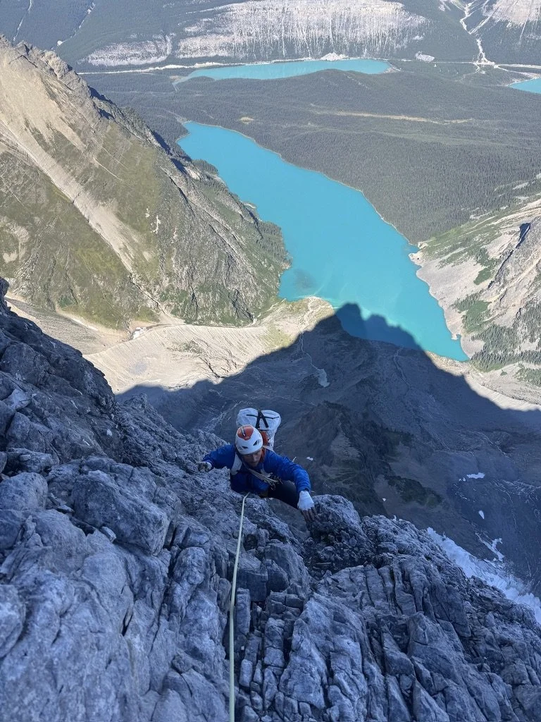
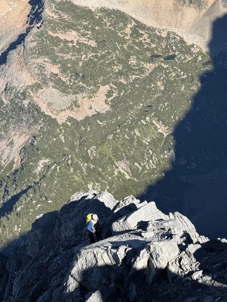
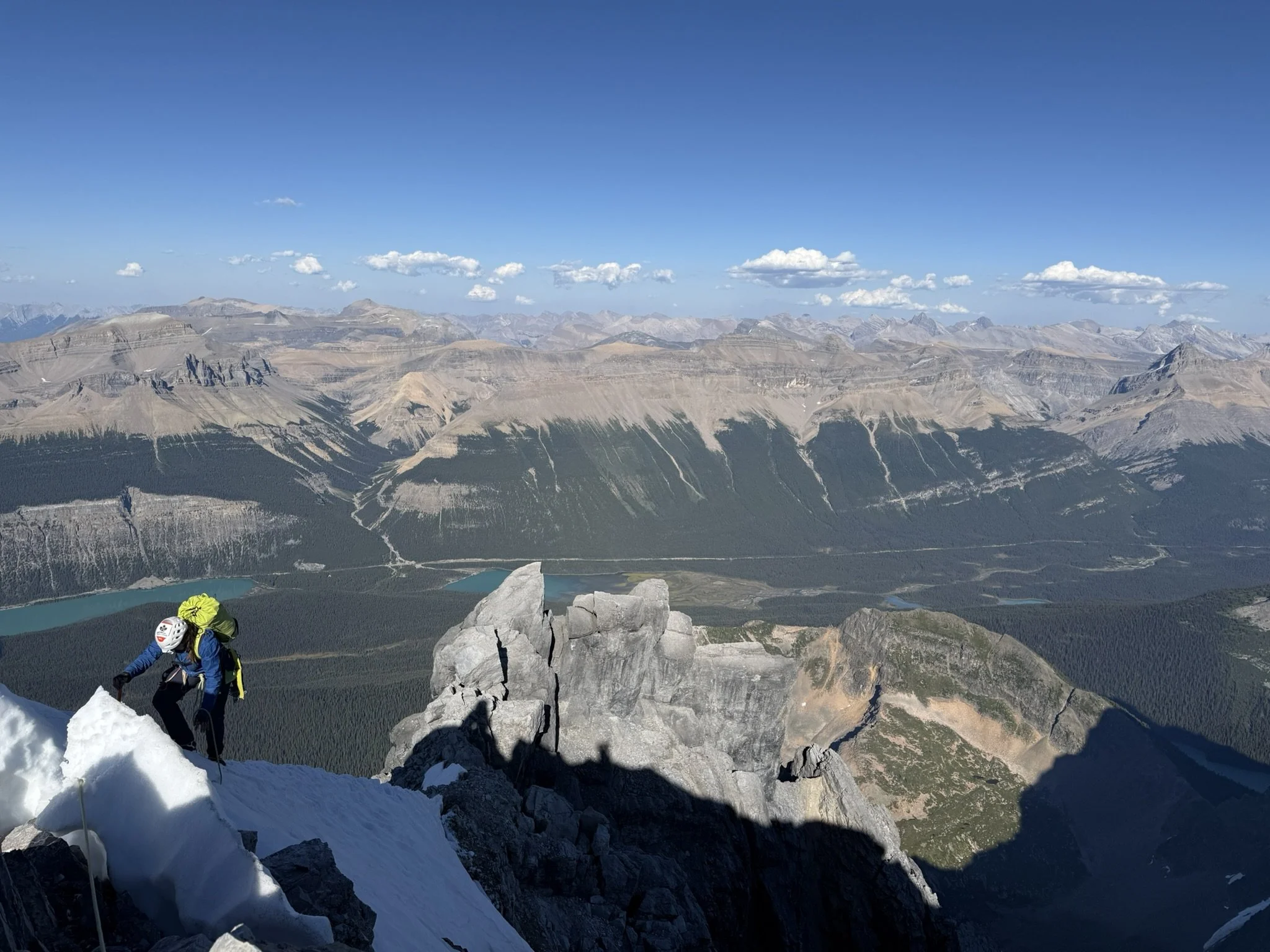
Sara took off and made quick work of the crux pitch — the rock was relatively good on the black band as a nice change. The higher up we got on the route, the more the quality of the climbing improved. Some of the features along the upper ridge were exceptionally enjoyable to scramble around on, as by this point the difficulty of the climbing had eased back considerably. Gaining the summit proper proved to be straightforward, as the upper reaches of the buttress were more or less devoid of any snow, except for one tiny patch remaining on the final traverse over to the summit. We enjoyed the amazing views for a bit before packing up the kit and starting the walk down — at least we thought it would be a relatively casual walk down the glacier.
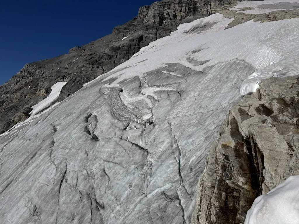
After about ~400 meters of descent via scree and some easy snow slopes where the glacier proper makes a turn north, we discovered with great sadness it would not be a casual affair after all. As is the case with many of the glaciers and icefields in the Rockies, they are rapidly melting and becoming very difficult to navigate as a result. Some proper troubleshooting had us traverse into a prow of rock paralleling the glacier, where we were able to set up a few rappels that had us bypass the steepest and most broken parts of the ice. Unfortunately this too took a good chunk of time to sort out, which meant that if we wanted to finish the journey back too, we’d be pulling a very late night.
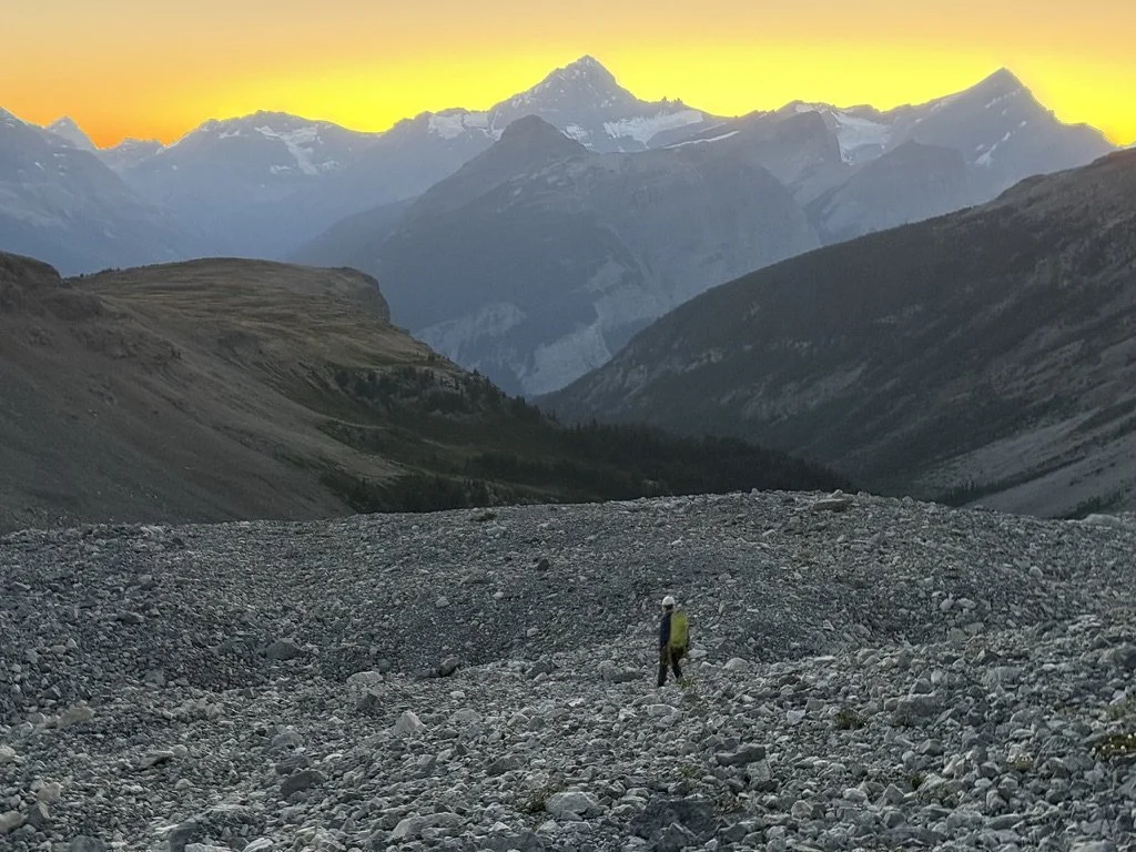
Rather than going for the big push, we just decided to enjoy one more evening out, as the weather was still excellent, and this way we would be sure to avoid any kind of alpine hangover. It also meant we could navigate the rest of the way out in the daylight, including crossing the river, which we anticipated could be quite a swim across. The only downside was by this point we were properly out of food — still we both seemed to function remarkably well without much more than a few bars to eat each day. The hardest part about getting going in the morning was the lack of coffee, and I’m sure I was going through some sort of caffeine withdrawals. The worst part was we still had plenty of fuel but for some reason had not thought to throw in a handful more instant coffees. This was perhaps the starkest lesson of the trip: always bring extra coffee.
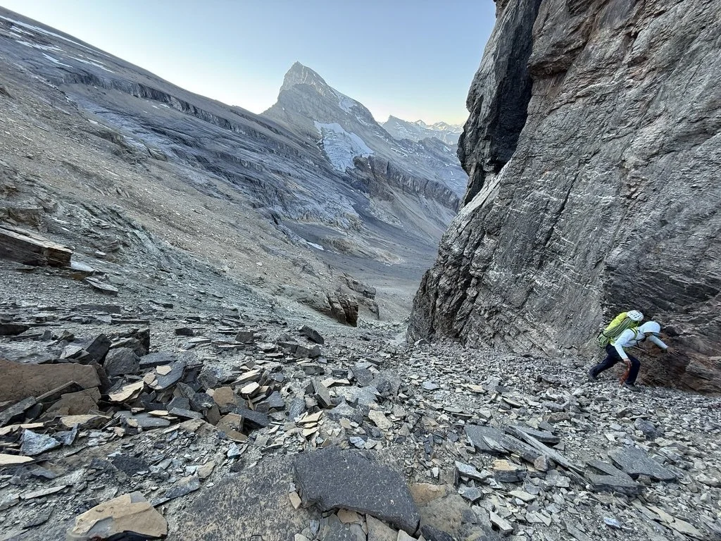
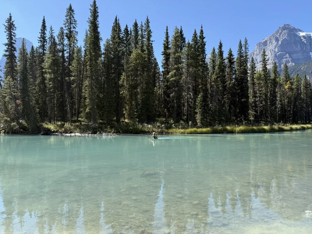
The slog up to the White Pyramid–Epaulette col turned out to be straightforward despite looking a bit unpleasant from afar. The descent down the other side was steep gravel, which was less pleasant, but quickly deposited us on the White Pyramid glacier. We then followed the interminable moraines down to treeline, where about another hour or so of bushwhacking had us back at the mighty Mistaya. Crossing the river ended up being almost enjoyable, as the water was cool and clean.